| Registration Classification | cultural heritage |
| Registration Criteria | (1),(2),(3),(4) |
| Year of registration | 1979 |
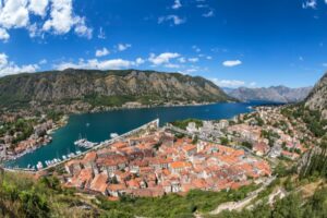
Kotor, located in southwestern Montenegro, is a port town that takes advantage of the natural environment of the Adriatic Sea. Although many buildings were damaged by an earthquake in 1979, the town was registered as a World Heritage site and has been restored, and the medieval townscape can still be seen.
Here, a World Heritage enthusiast explains in simple terms why the Natural and Cultural-Historical Area of Kotor is a World Heritage Site. Read this and you will definitely learn more about Kotor!
What is the Natural and Cultural-Historical Area of Kotor? Explanation including Kotor Bay
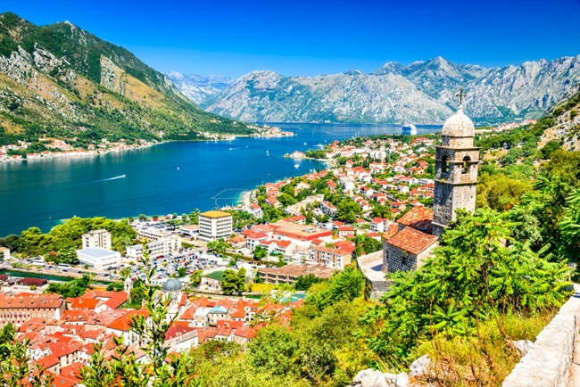
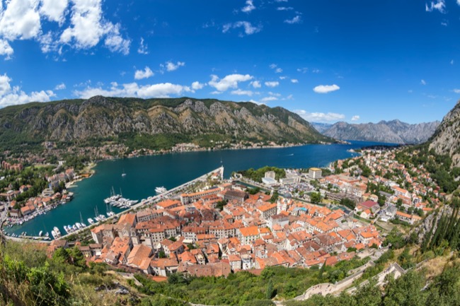
Located in southwestern Montenegro, Kotor is a port city on the Bay of Kotor along the Adriatic Sea. The registered site covers 1,400 square kilometers and is unique in that it includes not only the city of Kotor, but also the entire Bay of Kotor. The old town, with its palaces, monasteries, fortresses, and mansions, blends with the rias coast and the surrounding high mountains, creating a landscape unique to Kotor.
Kotor has its origins in Roman times and was already fortified in the 6th century. From the 10th century, the town developed as a trading town and became a leading city-state in Dalmatia, and from the 15th century, when the city was ruled by the Venetian Republic, the architecture was built in the Venetian style.
Main registered properties
St. Trypun Cathedral
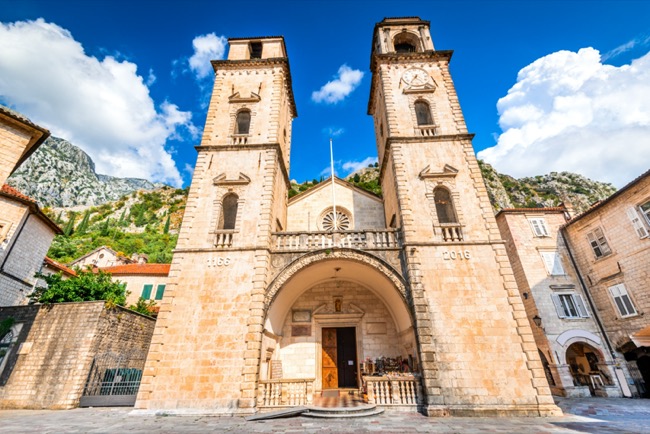


A Romanesque structure built in the 12th century, now a cathedral of the Roman Catholic Church.Trypun is the patron saint of the town. Although it has been damaged twice by major earthquakes, it has been restored each time.Except for the tower, the rest of the building remains as it was when it was founded, and some of the frescoes that were once used can still be seen today.
Sveta Nikola Square
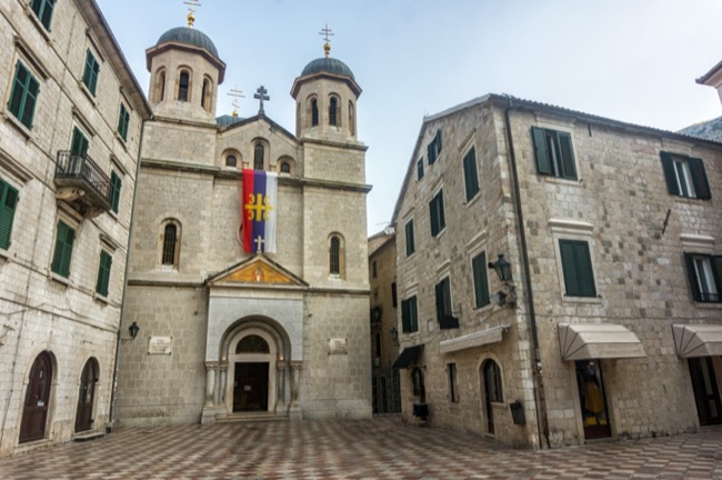


The center of the old town.Here are the Romanesque “St. Luke’s Church” built in the 12th century and the “St. Nikola’s Church” built in the early 20th century. Both churches belong to the Serbian Orthodox Church.
Church of Our Lady of the Rocks and St. George’s Island (Sveti Đorđe Island)
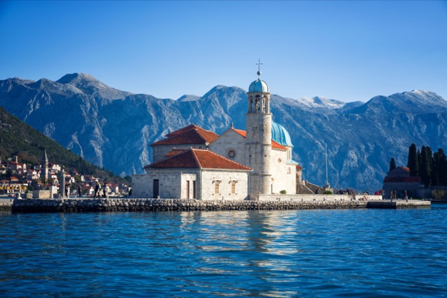


Perast is located 14 km northeast of the old town.There are two islands here, each with its own church on the Bay of Kotor. The Church of Our Lady of the Rocks was built with donations from the locals because of the presence of a statue of the Virgin Mary on the rocky shore. St. George’s Island, next to the Church of Our Lady, is home to a Benedictine monastery that dates back to the 12th century and looks more like a fortress than an island.
For what reason is the Natural and Cultural-Historical Area of Kotor on the World Heritage List?


Cottle was recognized for the following
Registration Criteria (i)
The fact that the city is clustered along the Gulf Coast and in harmony with the natural landscape.
Registration Criteria (ii)
That Kotor, as a trading city, deeply influenced the art, architecture, and crafts of the Adriatic coast.
Registration Criteria (iii)
The fact that the city was formed in harmony with nature and is still well-preserved and very unique today.
Registration Criteria (iv)
That the architecture of Kotor and Perast was planned to blend well into the landscape.
World Heritage Mania Conclusions and Comments
There are other fortified cities similar to Kotor registered on the Adriatic coast, such as Dubrovnik, but Kotor differs from the others in that it took advantage of the bay and the surrounding mountains to create a town. However, Kotor differs from the others in that it took advantage of the bay and the surrounding mountains to create a town that took advantage of the bay and the surrounding mountains.
Incidentally, there is a wall on the mountain side of the old town, from which you can see the whole area of the Bay of Kotor. The bay continues through the mountains, so you can clearly see how this place was a natural fortress.
Looking down from the top of the mountain, the old town looks triangular, and you also get the feeling that the buildings are forced to fit into the triangular container like a puzzle. ……However, climbing to the top requires a steep slope, so you must be physically fit to see this unique scenery!
*The content here is a discussion derived from research conducted by World Heritage enthusiasts.As for the data, interpretation differs depending on the media.
